From Town to City: Housing and New Neighborhoods
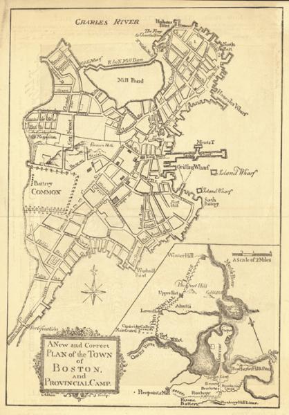
Figure 2: Map of Boston Prior to the 19th Century.
To manage the increasing population, Boston quickly created additional living spaces to not only accommodate the upper-class families who lived in the architecturally magnificent houses on top of the hill which overlooked the city, but they also provided the new settlers with affordable and low-income housing. By filling in the bay and almost doubling the size of Boston, new buildings and residencies were introduced in the Back Bay and the North and West Ends. Along with more housing, government and private subsidies quickly established new parks, markets, paved roadways and even railroads to provide convenient commodities for its residents.[1] With the additional support from the government and these private enterprises, Boston was able to develop more homes, businesses, and other amenities without its residents worrying about a lack of communal space.
Prior to the nineteenth century, Boston didn’t have one specific affluent neighborhood. However, as the Royalists began leaving with the British after the war, the city’s center quickly became a popular location for new business developments, while desirable neighborhoods began to expand towards other directions. With examples such as the development of the upper-class district of Beacon Hill by the Mount Vernon Proprietors in 1795, this ragged wasteland was rarely visited and had no residential housing. In addition, areas such as State Street and Tremont Street also provided beautiful and affluent housing.[1] Due to such a significant shift in the development of upper-class housing, many poor immigrants and other lower-income families were often pushed into the city’s central and downtown area where they lived in the least desirable and unflattering homes.
However, even with the expansion of Boston with the development of Beacon Hill, the city still didn’t have a sufficient amount of land. To accommodate the increasing population, developers also filled up the southern bay of the city, which consequently created the Neck, another affluent community where wealthy Bostonians moved to when Beacon Hill was filled.[2] With the development of the Neck, more families were able to find quality housing in desirable neighborhoods. Through such a rapid growth in population, it became necessary for Boston to create more land in order to provide an adequate amount of housing. Unfortunately, these new developments targeted higher-income families, forcing immigrants to stay in the slums.
Prior to the nineteenth century, the Neck was often unlivable due to the high tides that flowed into the area. However, after the war, a wall was built to block off these tides and by the 1950s, this area grew rapidly into a desirable neighborhood filled with beautiful red-bricked houses and gorgeous parks where residents lived in comfort.[3] Unfortunately, this South End neighborhood of Boston quickly deteriorated and became one of the city’s many undesirable slums. With an increasing number of European immigrants, there was a much higher demand for additional cheap housing and a strong desire for the elite to move out of these neighborhoods and into suburban neighborhoods leaving the poor in the city. Through the growing number of immigrants, many residents had a strong desire to move out of these slum neighborhoods and into areas where they would have to encounter poverty at a minimum.
One significant individual who was responsible for many of the changes in Boston’s urban planning during the nineteenth century was Charles Bulfinch. He designed many mansions for affluent residents in the West end and greatly contributed to the development of the new State House and the Beacon Hill area.[2] With the redevelopment of the new State House, the once rural neighborhood quickly transformed into the new political center of Boston, where new developers, such as the Mount Vernon Proprietors, began to purchase nearby lands and transform the farmlands into new residential neighborhoods. In order to accommodate these new neighborhoods, new streets were paved and the top of the hill was flattened to create more land at the top and additional property for the residents at the bottom.[2] Through the new developments on this new land and the new homes, architects such as Charles Bulfinch became even more influential as many of the Mount Vernon Proprietors purchased homes in these desirable neighborhoods and requested specially designed residences.
Another significant neighborhoods where new developments flourished during the nineteenth century was the Back Bay. With the filling of this area, additional lands were created which extended from Suffolk Street (present day Shawmut Avenue) to Castle Street, and Tremont Street to Roxbury. Through the development of this area, there was an increased number of streets in the area as well a significant widening of the streets as well.[3] With even more properties ready for purchase, many land owners were able to obtain more land than possible compared to any other part of the city. The Back Bay quickly became an area where wealthy families moved to keep distance from the undesirable neighborhoods. With the combination of gorgeous homes, beautifully paved streets, and the development of well-recognized organizations, the Back Bay gained recognition as Boston’s elite neighborhoods where the wealthy and fashionable resided. Compared with the rest of the city during this time that was filled with filth, overcrowding, and traffic, the Back Bay grew to symbolize the distinction between the rich and the poor.[4] However, even with the development of areas such as the Back Bay, there was still an insufficient amount of housing as Boston’s population and commercial growth continued to reach new highs. In addition, after several years of immigration, many of the Irish became much more economically stable and wanted to move out of the crowded tenements of the North End.
Aside from the developments in the South End, Back Bay, and Beacon Hill, there was also a significant change in the central downtown area of Boston. During the nineteenth century, many homeowners began to sublease their homes primarily to immigrants as they flooded into Boston. Unfortunately, the living standards in these areas were almost unbearable as landowners maximized shared spaces, such as gardens and yards by creating homes and quickly transforming the once abundant lands into Boston’s most infamous slums.[3] With such a tremendous shift of the physical appearance in these neighborhoods, the city quickly began to clear out the area in order to maintain a certain level of desirability within the community.
References:
[1] Holleran, Michael. Boston’s “Changeful Times:” Origins of Preservation and PLanning in America. Baltimore: The John Hopkins University Press, 1998. Print. 19.
[2] O’Connor, Thomas H. The Hub: Boston Past and Present. Boston: Northeastern University Press. 2001. Print.
[3] Whitehill, Walter M. Boston: A Topographical History. Cambridge: Belknap of Harvard University Press, 1968. Print.
[4] Puleo, Stephen. A City So Grand: The Rise of an American Metropolis, Boston 1850-1900. Boston: Beacon, 2010. Print. 98-100.
